This Just In: Mapping with Movable Types

This week we feature an acquisition made many years ago, but one whose true significance was discovered only this month. The Albert and Shirley Small Special Collections Library has long possessed a copy of Tableaux historiques & topographiques, ou Relations exactes et impartiales des trois événemens mémorables qui terminèrent la campagne de 1796 sur le Rhin (Basel: Chrétien de Mechel, 1798). Although lacking several plates, the U.Va. copy retains what turns out to be the key plate: a large folding map captioned “Retraite de Bavière en France … 26 Octobre 1796.”

“Retraite de Bavière en France … 26 Octobre 1796,” from Tableaux historiques & topographiques, ou Relations exactes et impartiales des trois événemens mémorables qui terminèrent la campagne de 1796 sur le Rhin (Basel: Chrétien de Mechel, 1798).   (DC220.8 .T3 1798)

“Retraite de Bavière en France … 26 Octobre 1796,” from Tableaux historiques & topographiques, ou Relations exactes et impartiales des trois événemens mémorables qui terminèrent la campagne de 1796 sur le Rhin (Basel: Chrétien de Mechel, 1798). (DC220.8 .T3 1798)

This plate is one of the few known examples of a map set entirely from movable types. Everything—text, borders, and topographic features—has been set by hand using a variety of text fonts as well as a specially designed cartographic font (here heightened with red and greenish-blue hand-coloring).

The map, "composed with movable types," bears the imprint of G[uillaume, i.e. Wilhelm] Haas, the Basel [Switzerland] typefounder who cut and cast the special cartographic font.

The map, “composed with movable types,” bears the imprint of G[uillaume, i.e. Wilhelm] Haas, the Basel [Switzerland] typefounder who cut and cast the special cartographic font.

Until the later 18th century, maps were printed in one of two ways: either from a relief block (typically a woodcut, with all non-printing areas cut away from the block’s top surface); or from an intaglio plate (typically an engraving, with the map’s lines cut into the surface of a copper plate). The same could be said for nearly all pre-1800 book illustrations, that is, they were produced using a limited repertoire of relief and intaglio processes—chiefly woodcut, wood engraving, engraving, etching, and mezzotint—rather than being set (like text) using fonts of metal type.

A detail showing the special symbols used to denote towns of various sizes, mountainous areas, rivers, roads &c. Note especially the tiny gaps (printing as white lines) between, e.g. the types used to set the meandering rivers.

A detail showing the special symbols used to denote towns of various sizes, mountainous areas, rivers, roads &c. Note especially the tiny gaps (printing as white lines) between, e.g., the types used to set the meandering rivers.

In the early 1770s, August Gottlieb Preuschen of Karlsruhe, Germany, invented an alternative to the printing of maps from engraved copper plates: a 21-character cartographic type font. Preuschen’s idea was realized through the technical skill of Wilhelm Haas, a typefounder in Basel, Switzerland, who perfected and cast the cartographic font and, in 1776, published the first map composed entirely from movable types. Over the next two decades, Haas continued to refine and expand his cartographic font until it contained at least 139 different characters, or “sorts.” These were special symbols, not letters, including 24 designed for depicting streams and rivers, 17 for borders, 14 for roads, 31 for charting military movements, 15 for human habitations, 6 for mountains and forests, and 32 for coastlines. All told, Haas employed his proprietary font to publish approximately two dozen typographic maps, including the “Retraite de Bavière en France … 26 Octobre 1796.”
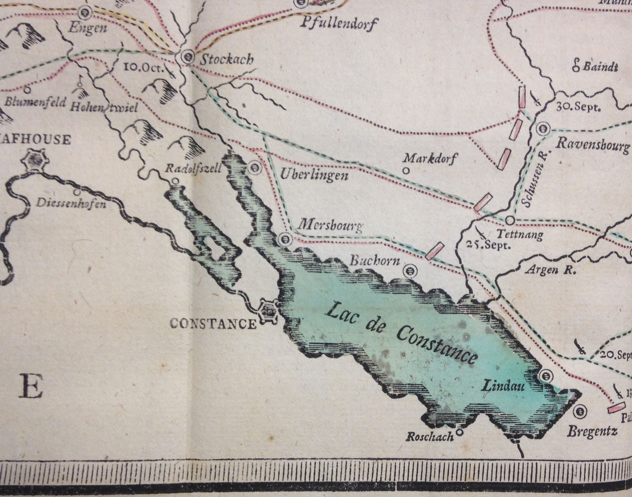
Note how the outline of Lake Constance is formed using separate pieces of type, each consisting of multiple horizontal lines; many of the pieces probably were individually filed down to create custom shapes. The bluish tint and red highlighting were hand-applied.

Note how the outline of Lake Constance is formed using separate pieces of type, each consisting of multiple horizontal lines; many of the pieces probably were individually filed down to create custom shapes. The bluish tint and red highlighting were hand-applied.

In setting these maps, Haas’s compositors worked from manuscript maps drawn on gridded paper. By breaking the complex cartographic image into small units, the compositors were better able to translate the image into small blocks of type metal. In doing so they faced two principal problems. First, the twists and turns of rivers and roads could be approximated but not rendered exactly, as could be done through engraving. Second, great care was needed to “lock up” these disparate assemblages of movable types so that they would not shift during printing. Type fonts are designed so that each sort has the same height, or “body size.” As long as each horizontal row of movable type contains sorts of the same height, a page consisting of several thousand small rectangles of metal type will “lock up” easily. Because Haas’s cartographic font contained sorts with a range of body sizes, which could not be arranged into uniform rows, it was necessary to painstakingly add filler material to the irregular gaps between types. In essence, the process was more like assembling a mosaic than setting type.
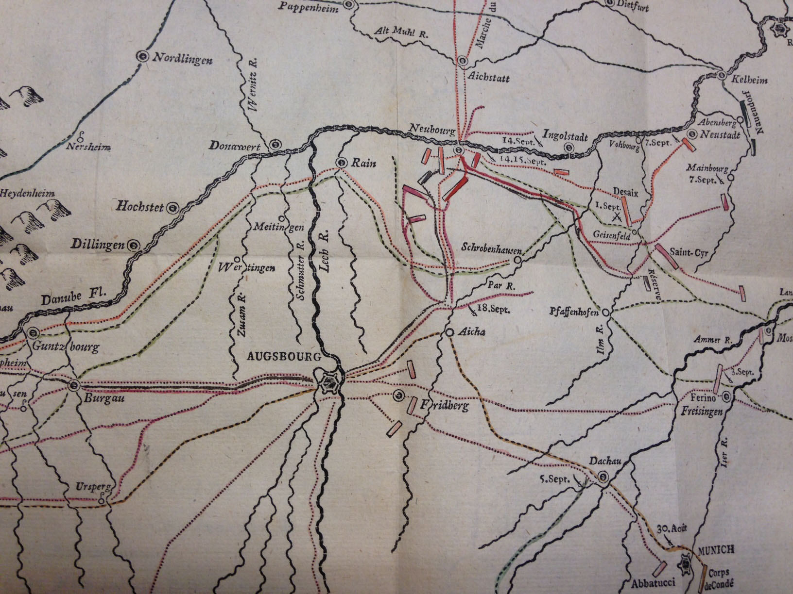
Haas's cartographic font contained types in at least five different widths for setting rivers and streams--note how some rivers progressively narrow in width. Rivers follow a meandering course, though their paths look more representational than accurate--a major limitation of Haas's font.

Haas’s cartographic font contained types in at least five different widths for setting rivers and streams–note how some rivers progressively narrow in width. Rivers follow a meandering course, though their paths look more representational than accurate–a major limitation of Haas’s font.

In principle, Haas’s cartographic font could claim several advantages over copperplate engraving: maps could be prepared more quickly, revision was easier, and unlimited impressions could be taken. But decided disadvantages remained for the prospective map publisher: only a limited level of accuracy could be achieved, and a large initial investment would be necessary to purchase the requisite types. Soon, however, the invention of lithography (and later, wax engraving) gave cartographers a far easier method for reproducing maps accurately, and Haas’s font was never adopted by other map publishers.

This Just In: Disability in the Archives

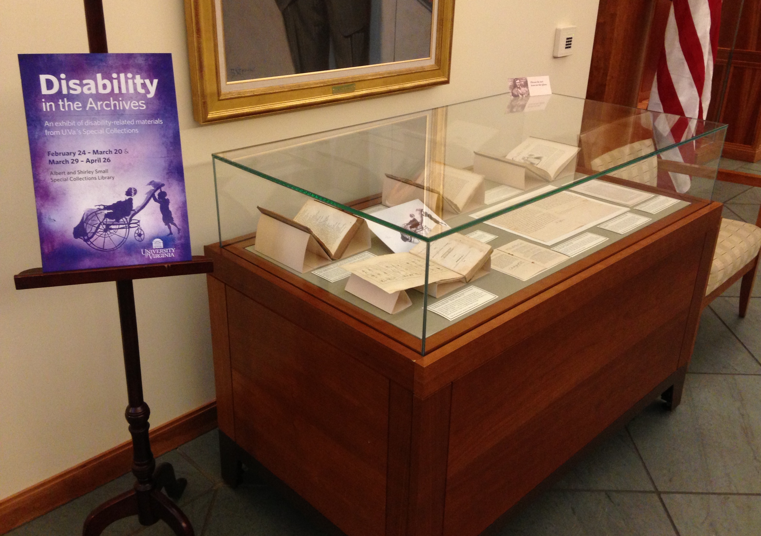
"Disability in the Archives," case 1

“Disability in the Archives,” case 1

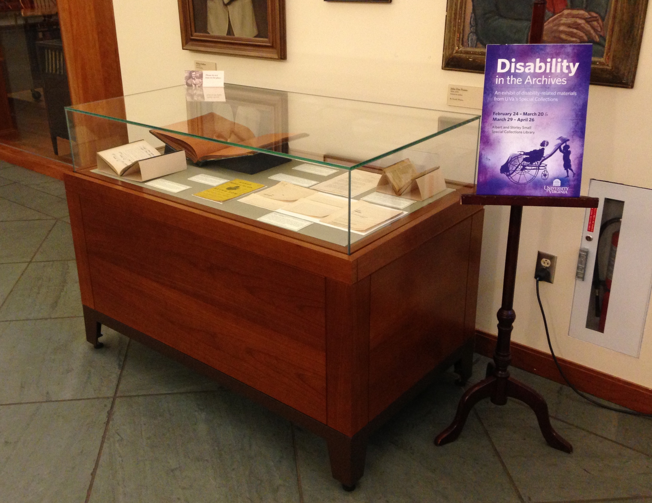
On February 27-28 U.Va. hosted “Disabling Normalcy,” an interdisciplinary conference organized by Christopher Krentz, Associate Professor of English and Director of American Sign Language.  In conjunction with the conference, Prof. Krentz and graduate student Philip Timmerman prepared an exhibition, “Disability in the Archives,” which is on view in the first floor gallery of the Small Special Collections Library through April 26. Drawn entirely from our holdings, the exhibition features books, manuscripts, and photographs relating to the deaf, blind, physically handicapped, and mentally ill.

"Disability in the Archives," case 2

“Disability in the Archives,” case 2

The exhibition includes several recent acquisitions, some obtained before Prof. Krentz proposed the exhibition and others acquired since, partly with the exhibition in mind.  In this post we feature a few of these items, including several omitted from the exhibition for want of space.

Efforts to educate the blind and vision-impaired received a major boost in the early 19th century with the invention of various tactile reading systems. Although Louis Braille’s dot system has become the international norm, raised letter systems were standard in the United States until the early 20th century. The first to be introduced was “Boston line,” an adaptation by Dr. Samuel Gridley Howe of a Scottish raised-letter alphabet. Much as a type designer adjusts letterforms for legibility, Howe adapted the shapes of letters and numerals so that, when embossed in paper in high relief, they could be more easily distinguished by touch. In 1835 Howe established a press at the New England Asylum for the Blind in Boston (now the Perkins School for the Blind in Watertown, Mass.), where he proceeded to print many raised-letter books for the blind.

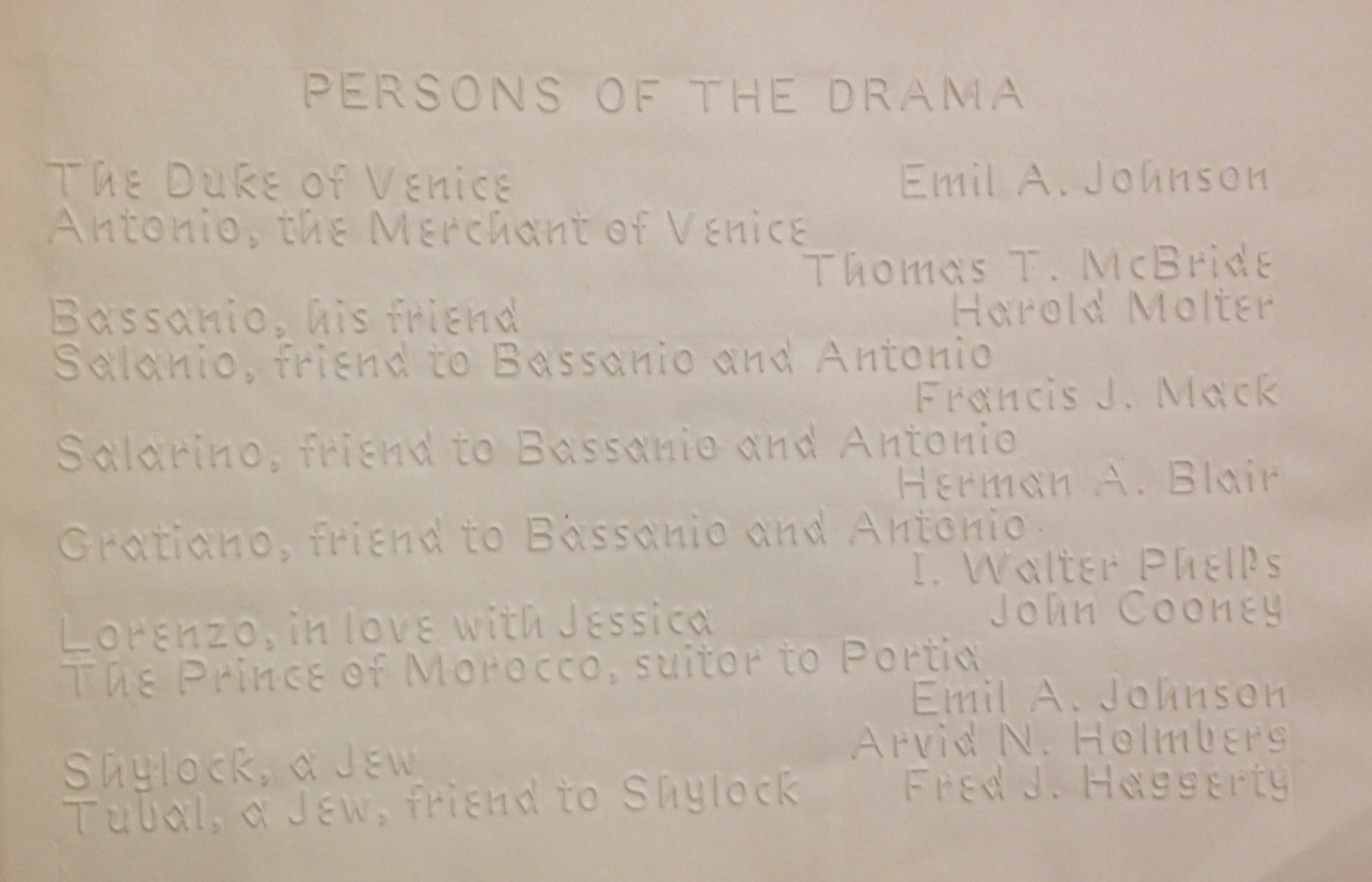
Cast list for a benefit performance of Shakespeare's The Merchant of Venice,  by the "Perkins Players" of the Perkins School for the Blind in Watertown, Mass., May 1917  (HV1796 .M46 P4 1917)

Cast list for a benefit performance of Shakespeare’s The Merchant of Venice, by the “Perkins Players” of the Perkins School for the Blind in Watertown, Mass., May 1917. This raised-print program was set in Boston line and printed at the school.  (HV1796 .M46 P4 1917)

We recently added an unusual Boston line imprint to our Joseph M. Bruccoli Great War Collection: a theater program for two benefit performances of Shakespeare’s The Merchant of Venice, held in May 1917 at the Perkins School and featuring Perkins students as actors, musicians, and dancers. Proceeds went to the American, British, French, Belgian Permanent Blind Relief War Fund, which assisted Allied soldiers blinded in battle.

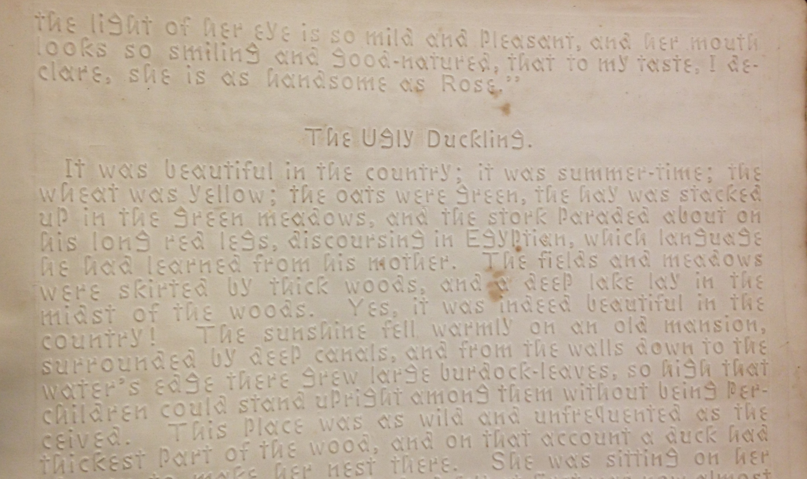
Hans Christian Andersen's The Ugly Duckling, from Fancies of Child-Life (Louisville, Ky.: American Printing House for the Blind, 1877).  (PZ7 .F1997 1877)

Hans Christian Andersen’s The Ugly Duckling, from Fancies of Child-Life (Louisville, Ky.: American Printing House for the Blind, 1877). (PZ7 .F1997 1877)

Following the Civil War, the American Printing House for the Blind in Louisville, Kentucky, became the leading American supplier of raised-letter texts. The APHB employed a modified form of Boston line for its publications until 1893, when Braille was first introduced. At the Boston International Antiquarian Book Fair we acquired a copy of the 1877 APHB edition of Fancies of Child-Life, a collection of children’s stories by Hans Christian Andersen and Harriet Beecher Stowe. This copy was sent to the Virginia Institute for the Deaf, Dumb, and Blind in Staunton, Va., where in 1893 it was presented as a school prize “For learning to read in one Session” to Edgar Hickam. A blind resident of Maces Spring, Va. (in the extreme southwest region bordering Tennessee), Hickam was well known locally as a musician and piano tuner, though celebrity would fall, not to him, but to his neighbors, the Carter Family.

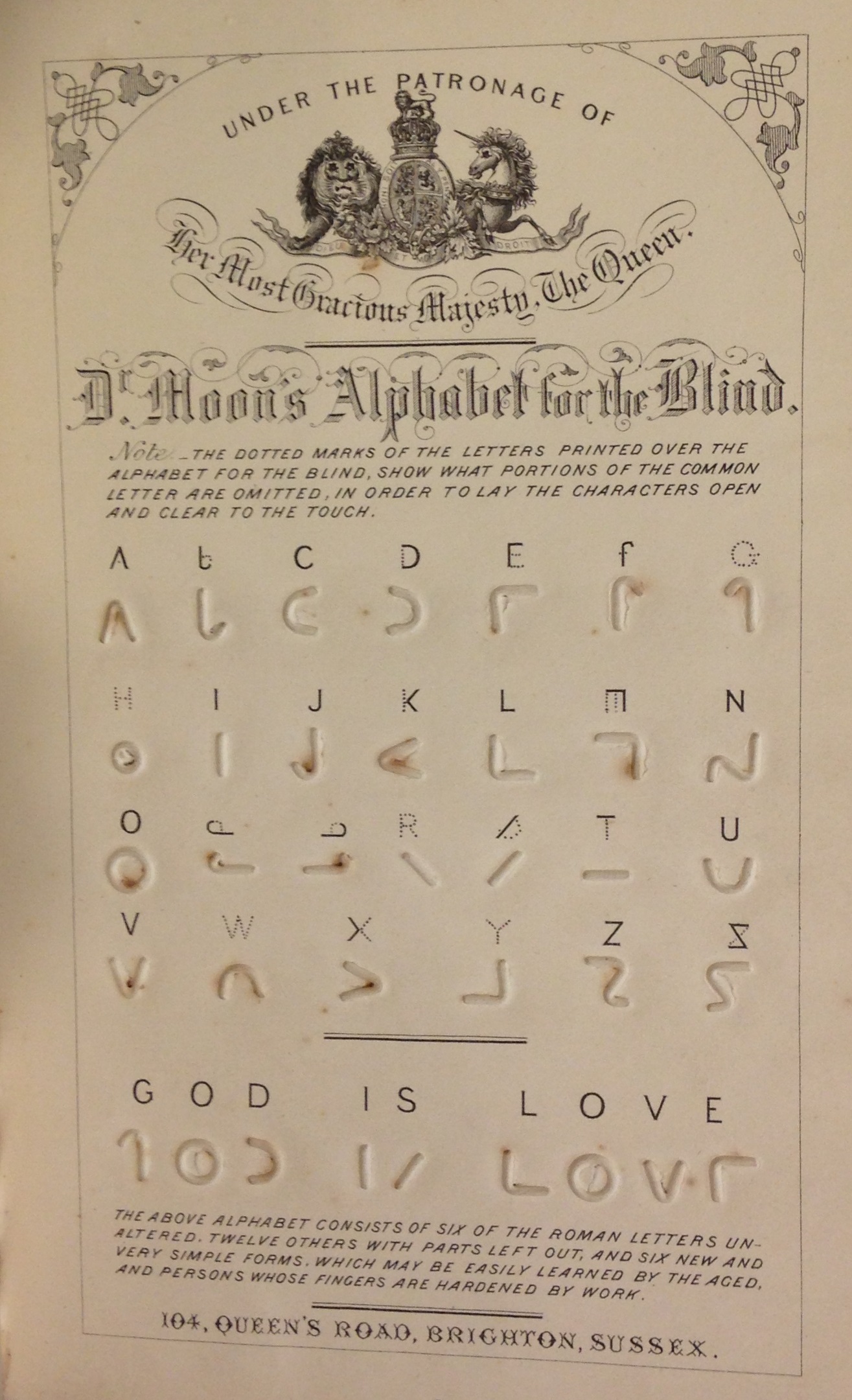
The Rev. William Moon's simplified manual alphabet, in Light for the blind: a history of the origin and success of Moon's system of reading (embossed in various languages) for the blind (London: Longmans & Co., 1873).  (HV1678 .M84 1873)

The Rev. William Moon’s simplified manual alphabet, in Light for the blind: a history of the origin and success of Moon’s system of reading (embossed in various languages) for the blind (London: Longmans & Co., 1873). (HV1678 .M84 1873)

Perhaps Boston line’s primary shortcoming was that it adopted essentially the same rather complex letterforms employed for written and printed texts. Hence publications in Boston line are more easily read by eye than by touch. In 1847 the Rev. William Moon of Brighton, England, invented a simplified alphabet better suited to touch. It consisted of “six of the roman letters unaltered, twelve others with parts left out, and six new and very simple forms, which may be easily learned by the aged, and persons whose fingers are hardened by work.” Moon’s Light for the blind (London, 1873) describes his invention, provides a list of available publications, and chronicles his labors on behalf of the blind.

We know far less about the history of mapmaking for the blind, and embossed maps are very uncommon.  Hence we were delighted to acquire at the California International Antiquarian Book Fair a fine copy of a world atlas for the blind published in Germany in the mid-1930s. The challenge was a straightforward one: how to convert two dimensions into three so that cartographic information could be conveyed by touch?  Here the solution was to emboss maps in high relief on durable kraft paper. Geographic and topographic features are differentiated as follows: coastlines by dotted lines, political boundaries by dashed lines, rivers by solid lines, oceans by a uniform pattern of small dots in low relief, and so on, with captions added in Braille.

A manual alphabet from a collection of ornamental alphabets, Recueil d'alphabets, dedié aux artistes (Paris & New York: L. Turgis jeune, [ca. 1845?].  (NK3600 .B65 1845)

A manual alphabet from a collection of ornamental alphabets, Recueil d’alphabets, dedié aux artistes (Paris & New York: L. Turgis jeune, [ca. 1845?].   (NK3600 .B65 1845)

Last month we acquired a rare mid-19th century alphabet book, with a dual Paris & New York imprint, consisting of 24 lithographic plates bearing elaborate ornamental alphabets. These were intended as inspiration for artists, signmakers, and others seeking out-of-the-ordinary letterforms. Imagine our surprise to find on the penultimate plate the standard manual alphabet on which various sign languages used by the deaf (including American Sign Language) are based.

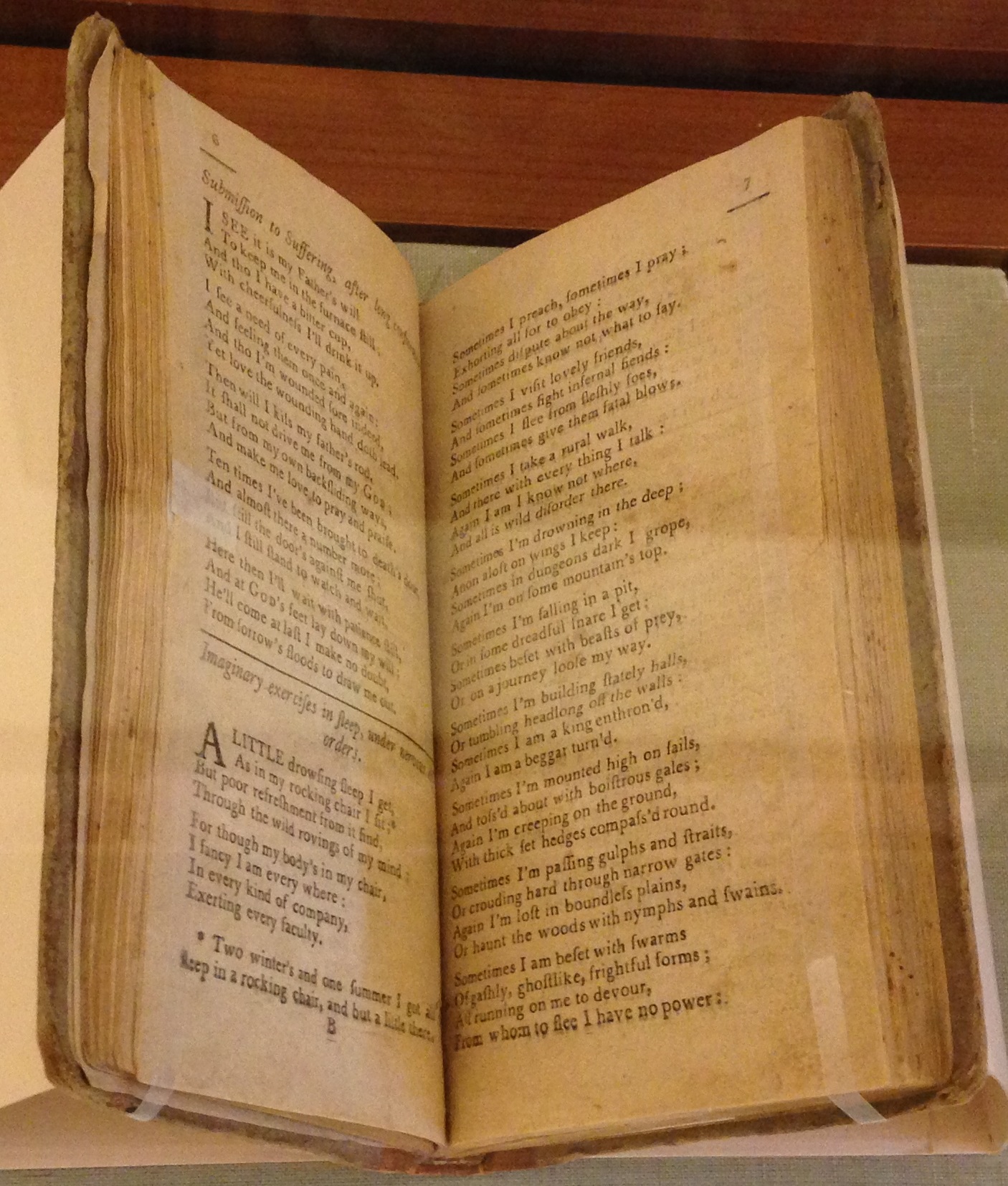
Nervous disorder conveyed in verse, in Miscellaneous reflections. In Verse (Greenfield, Mass.: Thomas Dickman, 1792)  (BD420 .F52 1750 no. 2)

“Nervous disorder” conveyed in verse, in Miscellaneous reflections. In Verse (Greenfield, Mass.: Thomas Dickman, 1792)   (BD420 .F52 1750 no. 2)

Early autobiographical accounts of battles with mental illness are quite rare, and recently we acquired one for the Clifton Waller Barrett Library of American Literature. In 1792, in the small town of Greenfield, Mass., Thomas Dickman printed Miscellaneous reflections. In verse. Mostly written at sundry times, when under long confinement by a complication of nervous disorders. Only three copies are recorded of this 40-page pamphlet, written “by a valetudinary” (whose identity remains unknown) and “printed by request of friends of that class.” Most of the poems are religious in nature, but the initial poems are extraordinary for attempting to convey, in verse, the author’s experience of being in a state of “nervous disorder.”

Class Notes: Mapping the Globe from Ancient Times to Google Maps

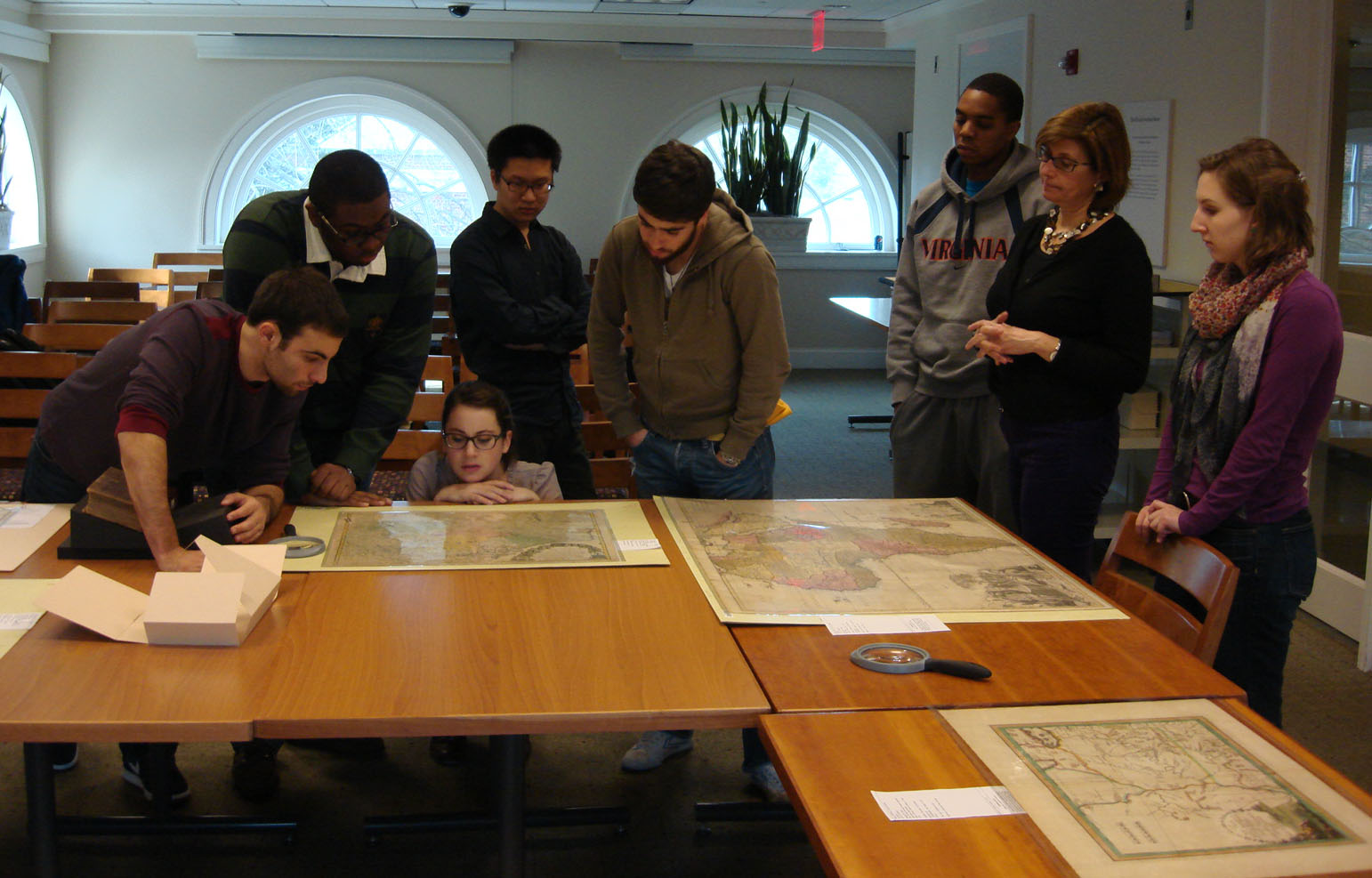
Fresh into the new year, Associate Professor Francesca Fiorani brought her January Term class, Mapping the Globe from Ancient Times to Google Maps, to Special Collections to take advantage of our extensive map collection. This particular course focused on the visual, linguistic, political, and religious rhetoric of maps and map making.

Francesca Fiorani (second from right) and her January Term students examine a map. (Image by Petrina Jackson)

Professor Fiorani’s engaged and intense group of students spent six sessions in Special Collections, examining, thinking about, and challenging themselves and their classmates while studying some of our most exquisite maps.  The class later went to the University of Virginia Library’s Scholars’ Lab to explore Geographic Information Systems (GIS), which captures, analyzes and displays maps electronically.

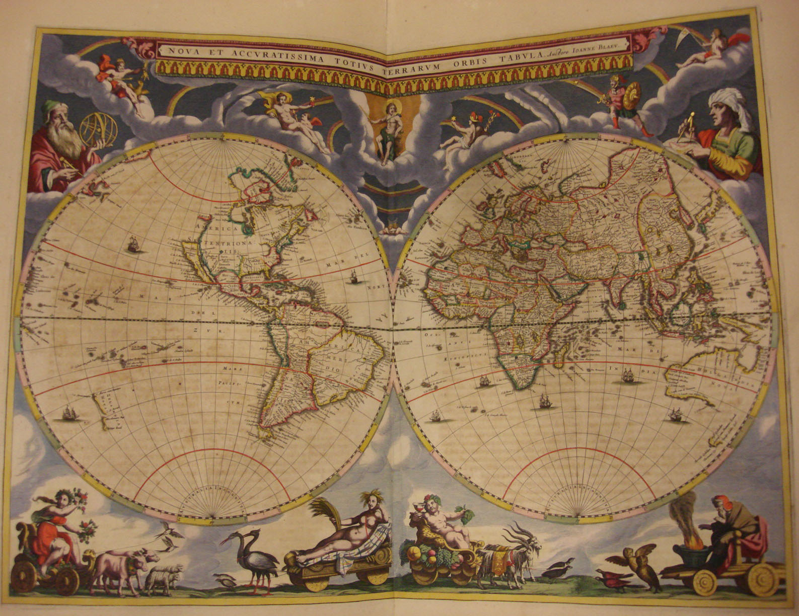
Map of the world from the Blaeu Atlas, 1662. (A 1662 .B53 v.1, Tracy W. McGregor Library. Image by Petrina Jackson)

To measure the impact of seeing the maps in person, I asked the students, “How would your experience be different if you only saw these maps in digital form?” Here are some of their responses:

“Being able to see these maps in person allows for greater understanding and appreciation for the worksmanship and detail that would perhaps be lost if [they were] seen only in digital form.  Seeing the actual physical size and dimensions of these maps provides greater insight into how these maps would have been used or displayed when [they were] originally published.”

“These maps represent the work of many individuals and being able to see first-hand the mapping activity of the past, through manuscripts and facsimile, gave me a better understanding and appreciation of the objects themselves.”

“Having tangible maps also makes the class seem more authentic.  I like having a hands-on education.”

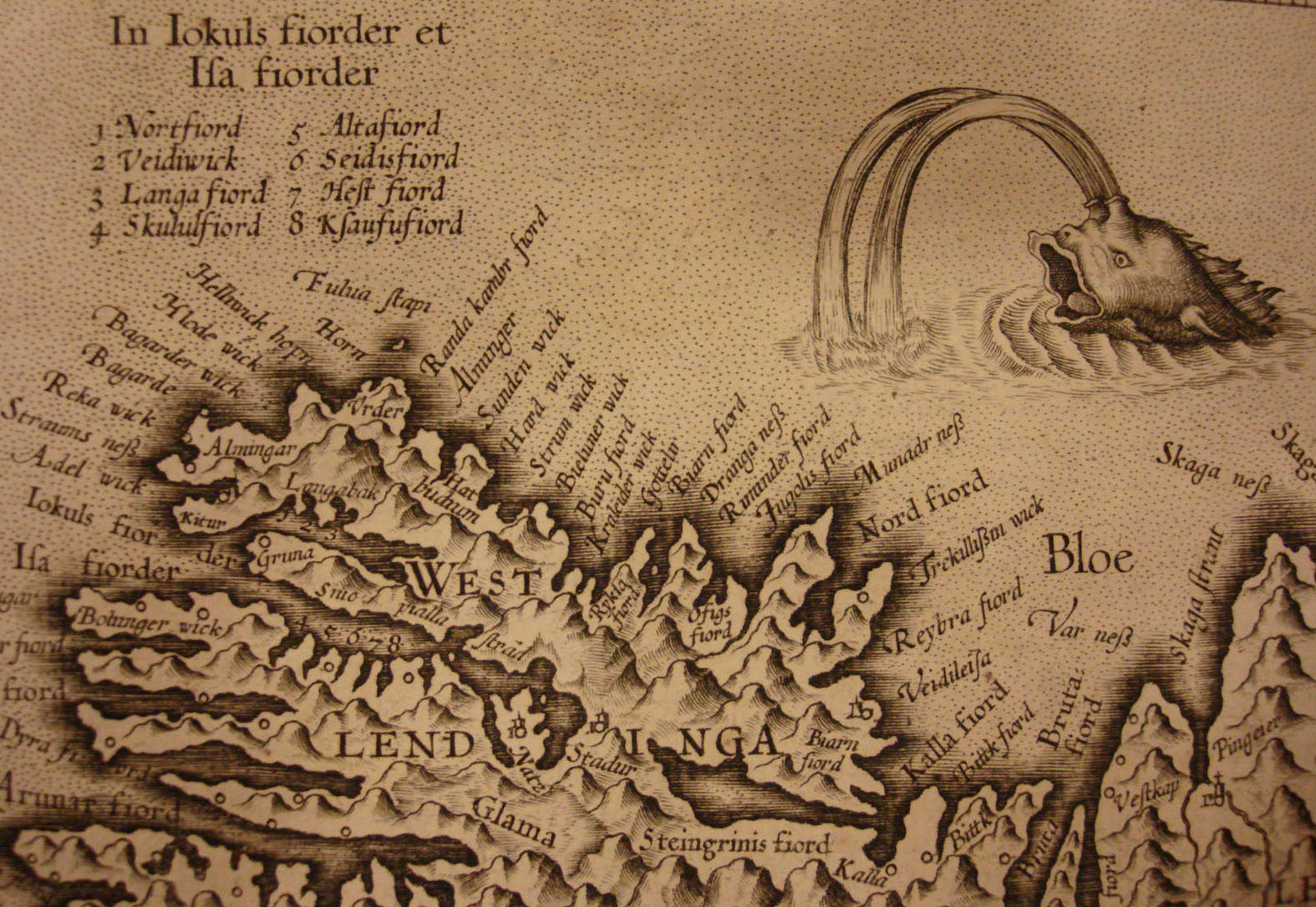
Detail from the map of Islandia (Iceland) from the Mercator Atlas, 1606. (A 1606 .M47, Tracy W. McGregor Library. Image by Petrina Jackson)

I also asked the students what surprised them about the maps they saw in Special Collections and got a variety of responses.  The following was the most representative:  “I was surprised by the size of some of these maps.  Having seen many on the computer screen, I was floored by the actual sizes, both enormous and small, [in which] these maps have come to us.”

Map of Virginia and Carolina by Giovanni Maria Cassini, 1797. (Area Table 75 1797 Cassini, Tracy W. McGregor Library. Image by U.Va. Library Digitization Services)